This webpage is not updated over the weekend/overnight. For up-to-date information on traffic impacts, visit 511mn.org.
About this project

Hiawatha Ave. project location map
We are making pedestrian safety and accessibility improvements to the intersections of Hwy 55/Hiawatha Ave. and 46th St. East and 45th St. East in Minneapolis. When the work is finished, these intersections will be safer and easier for pedestrians, bikers, transit users, and drivers to navigate and use.
Summary of work
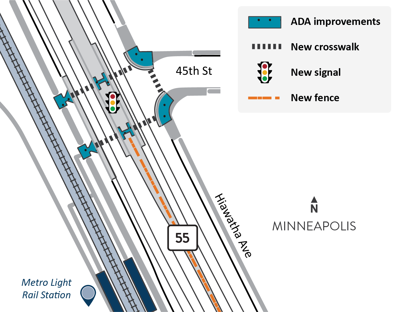
Hiawatha Ave. at 45th St. East
- Add new pedestrian signal at 45th St. East
- Add new crosswalks to north and south sides of 45th St. East across Hiawatha Ave.
- Add new crosswalk across 45th St. East
- Add new fencing to the median between 45th St. East and 46th St. East
- View map of improvements at 45th St. East (PNG)
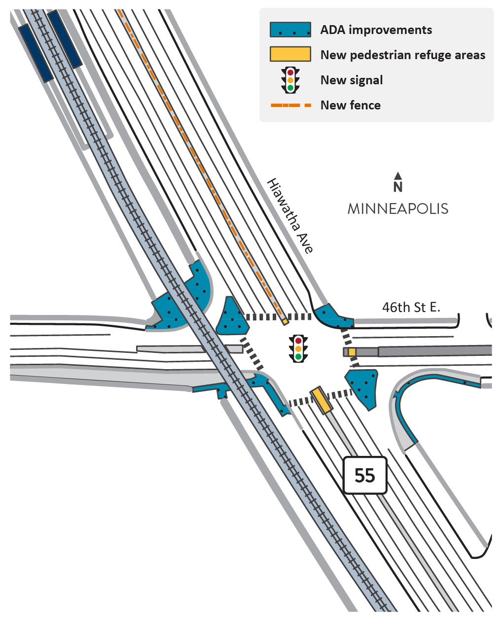
Hiawatha Ave. at 46th St. East
- Add new pedestrian refuge areas
- Reconstruct turn lanes on southeast and northwest corners of Hiawatha Ave. and 46th St. East for safer turn speeds and better sightlines
- Build out curbline on 46th St. East to reduce pedestrian crossing distance across 46th St. East
- Realign trail crossing at the light rail tracks for safer cross
- Replace traffic signals at 46th St. East
- Add new fencing to the median between 45th St. East and 46th St. East
- View map of improvements at 46th St. East (PNG)
Traffic impacts
All traffic impacts are tentative and weather dependent.
Upcoming
Information about upcoming traffic impacts will be added as details become available.